Nashville Properties | Diaspora Assistance | Asokoro | Guzape | Katampe | Apo | Idu | Pyakasa | Lugbe | Kuje | Kurudu | Maitama | Kubwa | Jikwoyi | Kyami | Gwarinpa | Karmo | Karsana | Abuja | Nigeria
Land Development in Abuja FCT

Develop with Nashville Properties

Land infrastructure, layout planning, and FCDA Master Plan compliance across fifteen Abuja districts. Diaspora assistance available for clients managing development projects from abroad.

Developing Land in Abuja

Feasibility & Layout Planning

A plot of land in Abuja requires proper development to become usable. Nashville Properties manages the transformation of raw land into serviced plots ready for construction or sale. The first step is a feasibility study that examines the plot's location, size, and zoning classification under the FCDA Master Plan. Apo, Asokoro Extension, Guzape II, Katampe Extension, and Maitama II have stricter development controls, while Lugbe, Kuje, Kurudu, Dei-Dei, Kubwa, Jikwoyi, Kyami, Idu, and Pyakasa have different requirements. The findings are compiled into a report that guides every subsequent decision.

To begin, the development plan takes shape with road layouts designed to maximize plot utility and accessibility, drainage channels mapped to prevent waterlogging, and plot demarcation carefully calculated to meet minimum size requirements. The plan is then cross-referenced against AGIS records to confirm title validity and survey plan accuracy before anything moves forward.


A middle-aged Nigerian land surveyor with a neatly trimmed goatee, wearing a white hardhat, bright orange reflective vest, and black work boots, standing confidently on undeveloped red earth in Abuja, holding a rolled survey plan with a warm confident smile, morning harmattan light
A mature Nigerian female architect with natural braided hair and glasses, wearing a tailored cream blazer, seated at a wooden desk in an Abuja office reviewing a development blueprint, warm focused expression, natural light

FCDA Compliance & Approvals

After that, FCDA Master Plan compliance is addressed with mandatory residential setbacks of 6 metres front, 3 metres side, and 3 metres rear built into the design. Zoning and district use limitations are strictly observed, and the plan is submitted to the Department of Development Control for review and approval. No physical work begins until the necessary clearances are obtained.

Infrastructure & Surveying

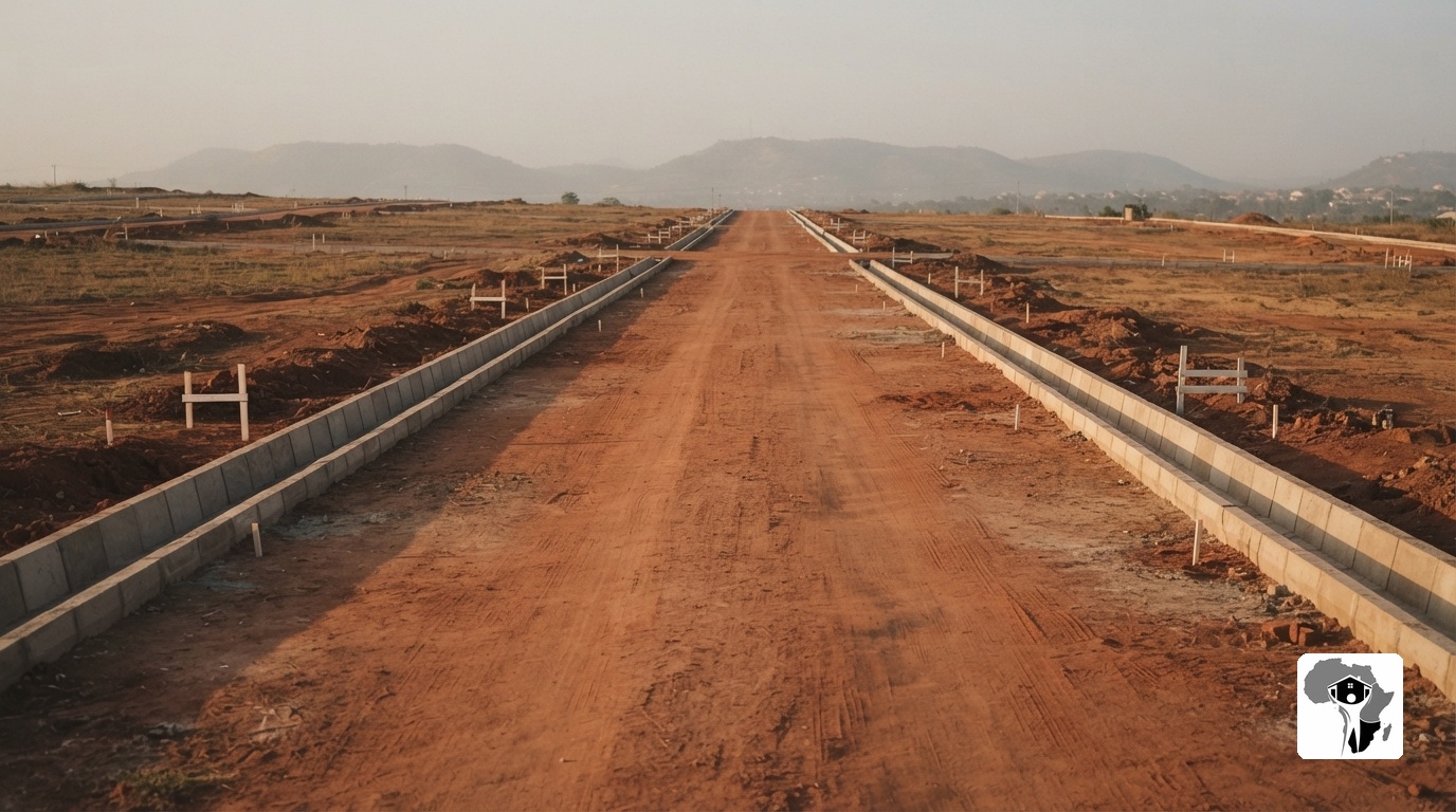
Next, infrastructure work commences after approvals are secured. Roads are constructed to the specified widths and materials, drainage channels are excavated and lined to handle storm water runoff, and perimeter fencing is erected where required by the development plan. Survey pegs are placed to mark individual plot boundaries with precision, and the site begins its transformation from raw land into a structured development.

A young Nigerian male engineer with a clean-shaven face, wearing a blue hardhat, bright yellow high-visibility vest, and work boots, kneeling on red earth to place a white survey peg with a mallet, focused expression, morning light
A wide shot of a newly constructed red-earth access road with concrete drainage channels on a development site in Abuja, small white survey pegs marking boundaries, morning harmattan light casting long shadows

Utilities & Project Handover

Then utilities follow with water supply lines laid according to the approved layout and electricity infrastructure installed where grid access is available. Access roads are completed, named, and recorded as the development takes its final shape. To complete the project, Nashville Properties prepares a comprehensive development file containing all plans, approvals, receipts, and correspondence. The survey plan is updated to reflect the new layout, and the completed development is handed over to the owner. For diaspora clients, regular photo updates and document management are provided throughout.

Start Your Development Project
Development Services

A close-up ground-level shot of heavily compacted red earth on a development site in Abuja, a single white survey peg driven into the dirt at the edge, natural morning light

Land Infrastructure

Roads, drainage channels, and perimeter fencing are constructed according to the layout plan and FCDA Master Plan requirements. Each element is built to the specified width and material standard.

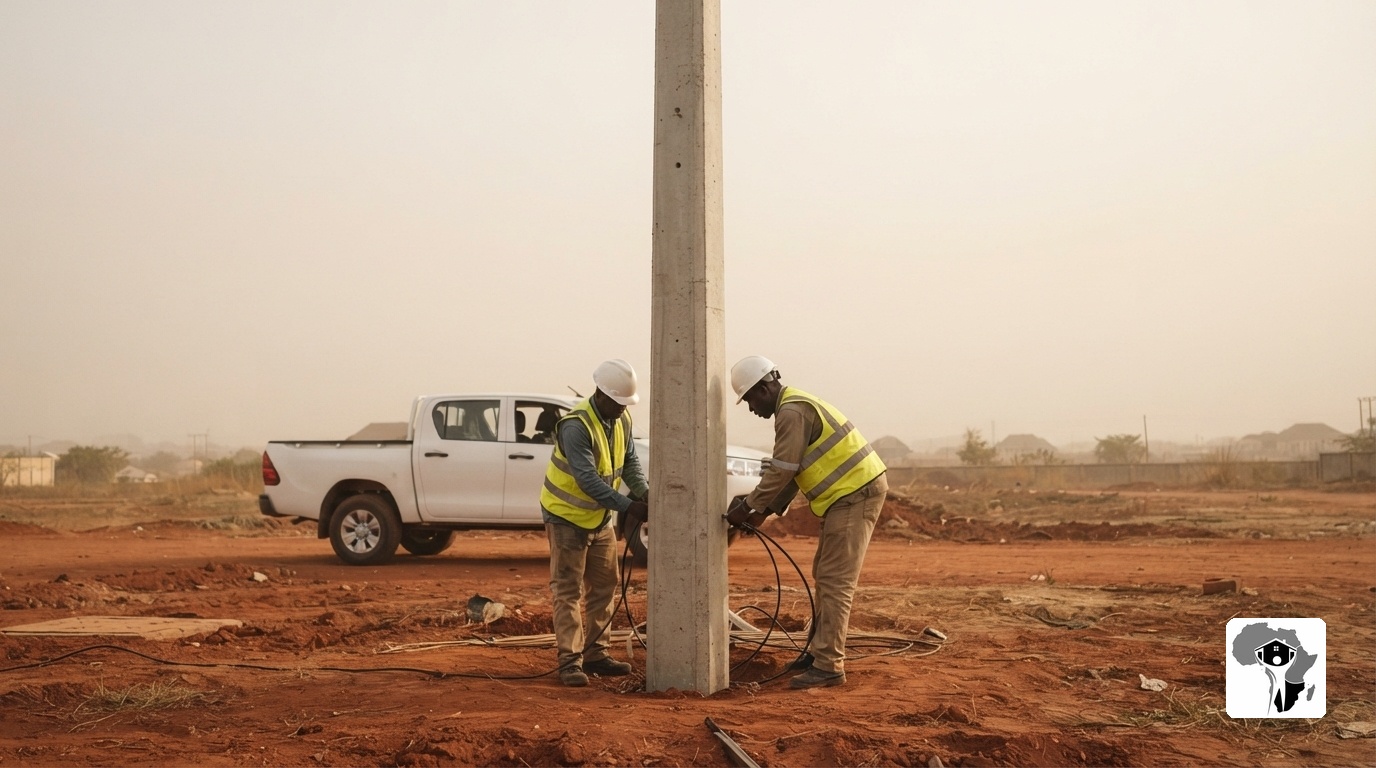
A tall concrete utility pole being installed on a red dirt development site in Abuja, two electricians in white hardhats and reflective vests working around the base under hazy harmattan afternoon light

Utility Connection

Water supply lines and electricity infrastructure are installed where grid access is available. Access roads are completed, named, and recorded in the development file.

A mature Nigerian male project manager with a short haircut and reading glasses, wearing a tailored navy blazer and holding a clipboard, standing on a red-earth development site in Abuja, looking toward the camera with a warm, confident smile, afternoon harmattan light

Project Management

End-to-end oversight of every stage, from feasibility studies and plan drafting to on-site inspections and final handover. Complete file management included.

A young Nigerian female surveyor with natural braids tied back, wearing a blue hardhat, bright yellow reflective vest, and heavy-duty work boots, standing on a red-earth plot in Abuja, holding a digital tablet with a quiet confident smile, hazy afternoon light

Diaspora Development Support

Remote assistance for clients abroad. Site inspections are conducted on your behalf, with regular photo and video updates sent throughout the entire development lifecycle.

Land Development Standards

FCDA Master Plan Compliance

All developments adhere to FCDA Master Plan zoning and district use limitations. Mandatory residential setbacks of 6 metres front, 3 metres side, and 3 metres rear are incorporated.

Development Control Approval

Drawings are submitted to the Department of Development Control. Approvals are secured before any physical work commences on site.

AGIS Verification

Development plans are cross-referenced against AGIS records. Title validity and survey plan accuracy are confirmed before the layout is finalized.

Complete File Handover

The owner receives a complete file containing all documents, approvals, and correspondence. Everything is laid out in plain terms anyone can follow.

Ready to Start?

Develop Land in Abuja

Nashville Properties handles land development across fifteen districts. Assess the land, prepare a development plan, obtain approvals, and complete infrastructure. Diaspora assistance is available for clients abroad.

Got Questions?

Questions Answered

How does Nashville Properties determine development feasibility?
Nashville Properties evaluates the plot based on location, size, and zoning under the FCDA Master Plan. A detailed feasibility report is provided to the owner before any development work commences.
What approvals does Nashville Properties handle for development?
Nashville Properties handles submissions to the Department of Development Control. Drawings are reviewed and approvals are secured before any physical work begins.
How does Nashville Properties support diaspora clients with development projects?
Diaspora assistance is available for development projects. Site inspections are conducted on behalf of the owner. Regular photo updates are sent. Document management continues until the development is complete.
What documents does Nashville Properties provide after development?
A development file is provided containing all documents, approvals, and correspondence. The survey plan is updated to reflect the new layout. Everything is laid out in plain terms anyone can follow.